
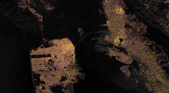
This is what more than 900 million Wifi routers and cell phone towers looks like. That’s one router for every 8 people on earth, all captured from Skyhook.
This is more points with attributes than I’ve ever put into a set of vector tiles before, but distilling big data down into tiles is exactly what Tippecanoe is meant to do. Key to keeping the tiles small enough is its feature that eliminates near-duplicate points at each zoom level, which would otherwise bloat the data without affecting the appearance of the map. A base zoom level of 14 had the correct balance to make individual tiles small enough while also keeping the total tileset a manageable size.
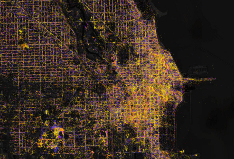
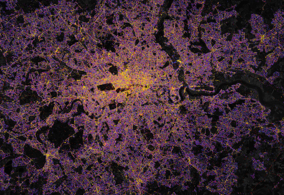
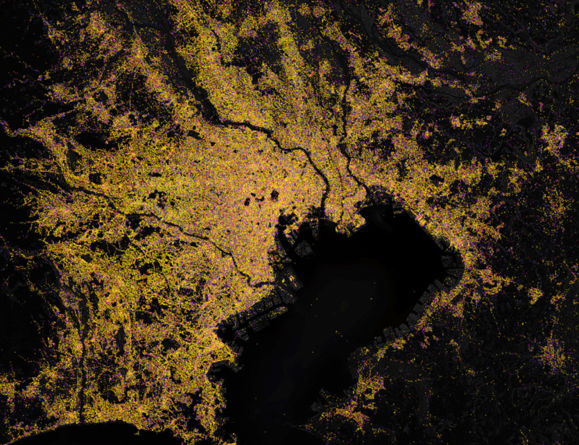
The most spectacular areas of the map are dense cities like Chicago, London, and Tokyo.
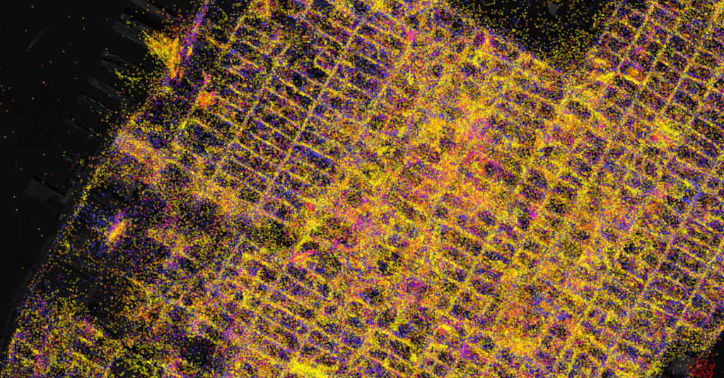
One of the most interesting things about this dataset is how it shows travel patterns and how places have changed over time. If you zoom out from the dense coverage of Manhattan, you can see neighborhoods full of yellow, all mapped within the last six months, where many people are constantly passing by with cell phones. The result is a snapshot of how people are moving through the city each day.
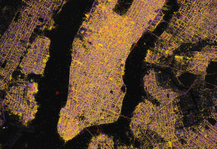
And if you zoom back in and look closely, you can see the ghosts of some old networks in blue, where schools, ballparks, convention centers, and ordinary people have replaced some of their routers with new ones, but the data for the old routers lives on.
Preluat: www.mapbox.com